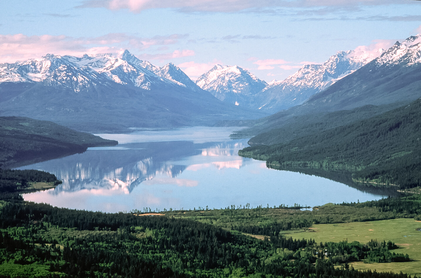
Tatlayoko Valley is in the upper Homathko River basin, a river which flows into 23km-long Tatlayoko Lake, and southward along a steep, glacially-modified valley to Bute Inlet on BC’s fjord coast. Homathko River is the first watercourse north of Fraser River to transect the Coast Range.
Physiography
The Tatlayoko Field Station in Tatlayoko Valley is located within a physically and biologically diverse area along the inland slopes of the Coast Mountains.
The broad region within which the Field Station is situated includes the low valleys and high peaks of the main Pacific Ranges to the south and west; the more subdued Chilcotin Mountains (of the Pacific Ranges) to the east; and the rolling, mid-elevation Chilcotin Plateau to the north. Numerous Pacific Range peaks exceed 3000 metres, with Mount Waddington at 4019 m being the highest mountain entirely within British Columbia; the most prominent summits of the Chilcotin Mountains are in the range 2500 to 3000 metres; and upper Chilcotin Plateau elevations are generally 1500 to 2000 metres, with peaks in the volcanic Rainbow-Ilgachuz-Itcha ranges exceeding 2000 metres. This vast area encompasses an exceptionally wide range of environments, from moist mountain slopes in proximity to the coast to the very dry plateau and from the low valleys to alpine rock and ice.
Major drainage systems to the east of Tatlayoko Valley include: Chilcotin River, which drains a large area of the Plateau eastward to Fraser River; Chilko River, flowing out of 64-km-long Chilko Lake, a lake which extends deep into the Coast Mountains, but drains northward to its confluence with Chilcotin River; and Taseko River, which flows out of Taseko Lakes, northward to a confluence with Chilko River. Westward along the Coast Range: Mosley Creek drains the Westbranch Valley, along the western slopes of the Niut Range south to its confluence with Homathko River; Klinaklini River, like the Homathko, cuts fully across the Coast Mountains to Knight Inlet; and Atnarko River and, further downstream, Bella Coola River drain the Charlotte Alplands area of the Coast Range, Charlotte Lake, and the western margins of the Chilcotin Plateau.
Read More...
The bedrock geology and surficial materials of the region are highly varied. The Coast Mountains are largely underlain by intrusive igneous rock, although locally, as in the Niut and Pantheon Ranges, there is a complex of lava, metamorphic, and sedimentary rock; the Chilcotin Mountains in the field station vicinity (for example, Potato Mountain) are faulted and folded sedimentary rock; and the Chilcotin Plateau is constructed mainly of Tertiary Period lava flows with metamorphic rock exposed in the Tatla Lake area. Surficial materials include extensive glacial till (with prominent valley-scale moraines), fluvio-glacial and alluvial materials in valley bottoms and lower slopes; colluvial materials and bedrock exposures on steeper slopes; an extensive glacio-lacustrine deposit within the Tatla Lake-Chilanko-Chilcotin River drainages; and frequent organic deposits present mainly as low-lying wetland fens on the Chilcotin Plateau.

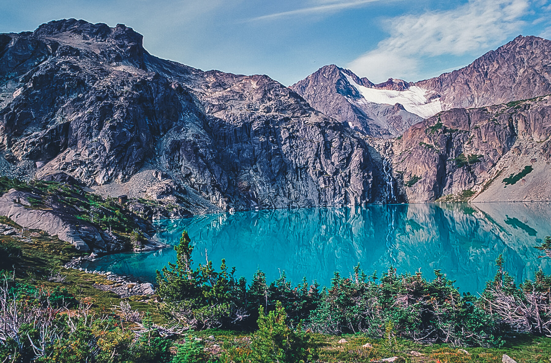
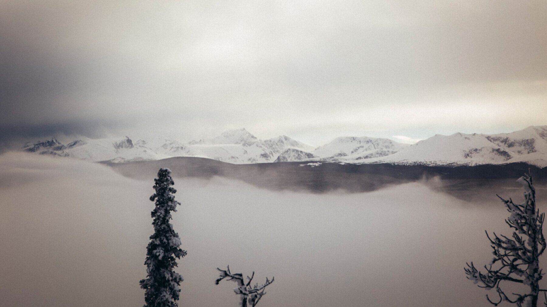
Glaciers and Icefields
A spectacular feature of the Pacific Ranges landscape is the great extent of mountain glaciers and icefields. The principal icefields in the region, from northwest to southeast, are the Monarch, the Ha-Iltzuk, the Waddington Range, the Whitemantle, the Homathko, and the Lillooet.
These icefields are the largest in the world in temperate latitudes, each with areas of at least 100’s of square kilometres. Inland (generally eastward) from these icefields the Alplands, the Pantheon Range, and the Niut Range, have many smaller, alpine glaciers (all of which are vulnerable to the warming climate).
The Largest Unroaded Area South of 52° Latitude
BLOG POST

Radial Divide Country
BLOG POST
Anahim Volcanic Belt
BLOG POST

Big Peaks, Big Ice
BLOG POST
Climate

Rain Shadow in Numbers
BLOG POST
There is a marked variation of temperature and precipitation from the Chilcotin Plateau to the adjacent valleys on the inland side of the Coast Mountains. The Plateau has a continental climate with cold winters and warm summers; whereas the upper valleys of Homathko River, Mosley Creek, and Klinaklini River are significantly moderated by their proximity to the coast. Most notable are the milder winters and limited snow cover in the valleys in the immediate lee of the mountains; for example, at the Tatlayoko Field Station just upstream of Tatlayoko Lake.
At upper elevations, from the slopes in the rainshadow of the Coast Mountains to the axis of the range, there is a steep precipitation gradient. Mean annual precipitation at 1700 m in the Waddington Range is approximately 2500-3000 mm (most falling as snow), which is 5-10 times the precipitation amount recorded at the same elevation adjacent to the Plateau. Similarly, along Homathko River valley, annual precipitation quadruples from the Tatlayoko Lake weather station (at the Field Station) to a station at the Homathko River-Scar Creek confluence, 50 km downstream of the Tatlayoko Lake outlet.
There are two very useful tools for accessing climate information for the region. The location and historic data for all weather stations collected by all agencies in British Columbia have been compiled and made publicly available by the Pacific Climate Impacts Consortium. Another agency, ClimateBC, has an application by which a range of climate variables and biogeoclimatic scenarios can be derived for present and future conditions. Climate and vegetation change projections for the 2020’s, 2050’s, and 2080’s can be calculated by application of a selection of models.
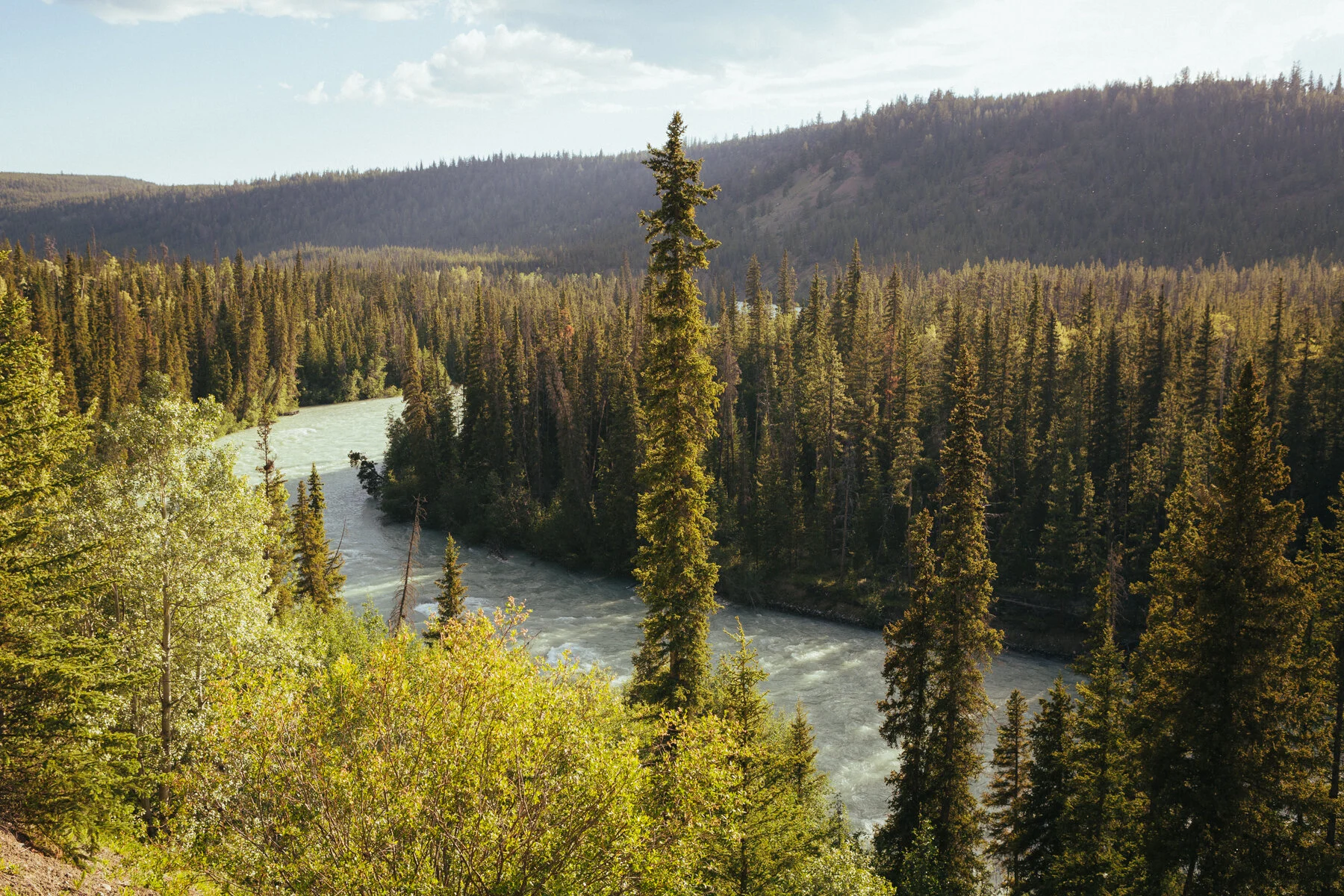
Streamflow
The flow regime of streams in the region is dominated by meltwater discharge beginning at low elevation in early April and peaking between late April and July, depending on basin size, elevation, and meltwater source. Higher elevation snowmelt typically peaks in late May and June, and streamflow derived from glacial melt peaks with summer temperatures in July. Although snow and glacier meltwater account for much of the annual streamflow, annual peak flows are frequently caused by rain or rain-on-snow events.
The lowest streamflows occur during mid to late summer with increased temperature and evapotranspiration. Maintaining sufficient flow for fish and other aquatic life is most critical at this time, especially where coupled with human use of water. There is generally a slight streamflow increase in the fall as evapotranspiration rates decline.